Showing posts with label Interconnection. Show all posts

Wednesday, June 25, 2014

Lionfish giving a roar in the Atlantic


Image above: The lionfish invasion


The lionfish invasion, a case study of environment, interconnection and sustainability


"The lionfish invasion is probably the worst environmental disaster the Atlantic will ever face" said Graham Maddocks, president and founder of Ocean Support Foundation


The story of the lionfish invasion of the Atlantic is a very useful case study for the geography class to explore the concepts of environment, interconnection, space, change and sustainability. After giving a brief overview of the issue this posting will provide information, videos and map visualisations to illustrate this fascinating and geographically useful case study of a little fish from the Pacific which has become a big problem in the Atlantic, wreaking havoc on the waters of the Caribbean and beyond. 

The story in a nutshell 

The lionfish, a native of the South Pacific region, has brought enormous change to the biodiversity of the areas it has invaded and is now the the most abundant top-level predator on some coral reefs in the Atlantic.

Lionfish were first recorded in 1985 in the Bahamas and since then their population has grown quickly. They produce 30,000 to 40,000 eggs every few days and are sexually mature by 1 year old. Today, you can find them throughout the Amazon, the Bahamas, the Caribbean and in the waters along North Carolina. As a non-indigenous species, lionfish are especially dangerous to the ecosystem because fish in the Atlantic lack a native instinct to stay away from them.

Although some commentators blame the breaking of aquariums during Hurricane Andrew for releasing lionfish to the ocean, it is more likely that they were introduced to the Florida area in 1985 when some pet owners released their lionfish when they got too big for their aquariums (DNA evidence traces all lionfish in the Atlantic back to only six to eight female lionfish). Having no natural predators in the area, scientists say it is up to humans, the fish's only known predator, to save the ecosystem.


Since being released they have altered the coastal ecology and an enormous amount of work is being initiated to limit their impact an spread. 

* Video introductions to the issue


* Map of current distribution: all from 6 lionfish released in 1985   

* World distribution map for lionfish, including projected future spread


There’s been a lot of buzz surrounding the lionfish invasion in the Western Atlantic, Caribbean, and Gulf of Mexico. With the invasion being a relatively new phenomenon (at least to most people), there’s bound to be some misinformation flying around. The National Geographic website explores the top five misconception about lionfish and the facts behind them. They say, quite correctly; ...'Knowing the truth behind lionfish puts us one step closer to figuring out a solution to the problem!' 


* Attempts to manage the invasion of lionfish

In January 2010 during the general assembly of the International Coral Reef Initiative (ICRI), the Secretariat agreed to set up an Ad Hoc Committee to develop a strategic plan for the control of lionfish in the wider Caribbean. Quite a task to control a species in waters they thrive in and have no predators.


The lionfish invasion is an interesting example of interconnection, environmental management and sustainability. Much research and management efforts is now taking place to avert ongoing ecological disaster. However, the likelihood of success is limited considering the nature of the lionfish and its adaptation and dominance of the Atlantic coastal environment.

Sunday, April 29, 2012

Interacting with the Interconnection concept

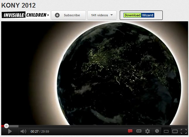
Kony2012: A geographical case study?


A world diminishing in size due to technology


Related sites to the Spatialworlds project
Email contact
manning@chariot.net.au
Where am I??
Adelaide, Australia: S: 34º 55' E: 138º 36'


The Interconnection concept


Following on from the Facebook connections map showcased in the last posting, I thought it worthwhile to explore the Interconnection concepts of the Australian Curriculum Geography. I was further prodded to do so after watching the YouTube video on the Kony2012 initiative.

I kept asking myself, is this geography and could it be used in a geography class?  Is it political geography, cultural geography, human well-being, development geography, demography?  Can such a phenomenon and resource be used as a case study in geography.  To explore this idea I revisited the Interaction concept (one of seven Australian Curriculum: Geography concepts) and had a look at several units which have been written for the draft curriculum released in October 2011 (namely Global Connections and Human Well-being).  So what is the concept of Interconnection according to the draft Australian Curriculum: Geography.

The concept of Interconnection (draft AC: Geography page 9) 

The concept of interconnection, in geography, emphasises that no object of geographical study can be viewed in isolation. It is about the ways that geographical phenomena are connected to each other through environmental processes, the movement of people, flows of trade and investment, the purchase of goods and services, cultural influences, the exchange of ideas and information, political power, international agreements and other types of interaction across space.

• exploring the networks that channel the interconnections between places, and which can advantage some places and disadvantage others
• learning to see their own locality in a wider national and global context, and gaining an understanding of the external factors that influence the locality’s present and future

The concept of interconnection is particular alive and well in the following units of the draft curriculum

The Year 9 unit called Navigating global connections

This unit focuses on the connectedness of Australia with its region and the world. This is explored initially through the eyes of the student and the connections and contacts they have with the wider world in their everyday lives. The unit then looks at the nature of Australia’s connections (with particular emphasis on social and economic connections) and the positive and negative impacts of these connections. The ability of a student to act locally, but with a regional and global view of the consequences is investigated.

Year 10 unit called Global well-being
This unit focuses on the nature of well-being around the world and how can it be measured. Spatial characteristics of well-being and the factors that influence it, and the inequalities that exist at a variety of scales, are used to investigate programs that address issues of well-being.

Content descriptions from unit
There are interrelationships between human well-being and conflict
  • There are significant spatial variations in human well-being within nations, at both regional and local scales 
  • A non-government program which attempts to improve human well-being in another country, and why such programs may be spatially targeted at specific regions within the country
  • People are connected to places across the world through their cultural interests and activities


There are many other places across the draft curriculum where the concept of interconnection is fundamental to the geographic understanding of the topic studied.  I have selected these units because they are particularly pertinent to using the Kony2012 initative as a case study of a geographical phenomenon. So how is the Kony2012 a geographical study. The following quotes from the video have a geographical and interconnection flavour which makes it possible as a geographical study under the guise of cultural geography and political geography in particular. 
  •  “Planet connection through technology.”
  •  “Technology enables us to connect anywhere, anytime ... This connection is changing the way the world works.” In short the video is highlighting the fact that technology is making space diminish through the power of technology leading to increased global interconnection.
  •  “There are more people on Facebook today than there were on the planet 200 years ago.”
  • “Humanities greatest desire is to belong and connect.”
  •  “Where you live should not determine whether you live?
  • “It is not just important for one people but for everyone to capture and stop Kony.
  • “Kony’s name needs to be everywhere.”
  • “Will use 20 culture makers to make Kony famous?
  • “Today the people of the world can see each other and can protect each other.”
  • “The power of media to mobilise the world to act.”
  • “To change the conversation of a culture.”
  • “We are living in a new world, a Facebook world where 750 million people share ideas, not thinking in borders, it’s a global community.”
  • “Arresting Joseph Kony will prove that the world we live in has new rules, that the technology that has brought our planet together is allowing us to respond the problems of our friends – a place where children, no matter where they live have a childhood, free from fear.”

Does this not sound like geography with its spatial and interconnection conceptualisation as discussed in the draft curriculum document? 

For more information on the Kony2012 initiative go to:

As a footnote to this reference to Kony2012 it is worth examining the controversy surrounding this initiative in terms of the recent reports on the use of funds, scamming accusations and the mental health of the film-maker Jason Russell, the driver of Kony2012. A fascinating case study, relevant to geography, populist media in nature, current with layers of truth and purpose.  Surely it can be made a geographical study to engage students and for them to learn about the concept of interconnection...and space.

 The Age of Interconnection: The Anthropocene


Whilst on the concept of Interconnection it is worth referring to the so called new age of the Anthropocene. The Anthropocene is best defined as the new human-dominated period of the Earth's history, the age of interconnection around the globe. 
Technically, the Anthropocene is the most recent period of the Quaternary, succeding to the Holocene. The Quaternary is a period of the Earth's history characterised by numerous and cyclical glaciations, starting 2,588,000 years ago (2.588 Ma). The Quaternary is divided into three epochs: the Pleistocene, the Holocene, and now the Anthropocene.The following links show this interconnection qualities of the Anthropocene rather well.


The term and the concept of the Anthropocene, the idea that human activity affects the Earth to the point where it can cross a new age, is not new and dates back to the late nineteenth century. It seems that the success of the term and its recent currency and adoption is due to the luck of having been made at the appropriate time, when humankind has become more than ever aware of the extent of its impact on global environment. 


Sunday, July 17, 2011

Creating the picture through other no less important concepts


Left image: Bongu; Mikloucho-Maclay's paradise.
Right image: Ashore at Bili Bili, home of the pottery in the Madang Province.

Related sites to the Spatialworlds project
Spatialworlds website
21st Century Geography Google Group
Australian Geography Teachers' Association website
'Towards a National Geography Curriculum' project website
Geography Teachers' Association of South Australia website
Email contact
manning@chariot.net.au

Where am I??
Melbourne, Australia: S: 37º 47' E: 144º 58'


Madang through the concepts of Change, Interconnection and Sustainability

In the last posting I painted an initial geographical picture of Madang, PNG through the concepts of Place, Space and Environment. In this posting I will add to the complexity and richness of the geographical picture of Madang through the no less important concepts of Change, Interconnection and Sustainability. As mentioned previously in the Spatialworlds blog, these are three of the seven concepts identifed by the draft Australian Curriculum: Geography which will soon be on-line for public consulatation(August-September 2011). In the meantime I have been writing these blogs on Madang to see if these concepts provide the richness and coverage as key geographical concepts for valid, elaborate and interesting geographical thinking.

More questions than answers but worth of geographical exploration and thinking

* Change

• Human contact with the New Guinea mainland has extended through the past 50,000 years
• The first European to spend any length of time on the PNG mainland was Russian biologist Nicolai Miklouho-Maclay. He arrived at Astrolabe Bay, south of the present site of Madang, in 1871 and stayed for 15 months
• Madang was first colonised by the Germans in 1884 (German New Guinea Company) arrived and tried to establish a base at various locations including at present day Madang but were continually beaten by malaria. They eventually moved to Rabaul. When in the province they established a settlement, developed plantation and built roads (the German presence can still be seen in the remnant plantations, old deserted settlements and various place names). The Lutheran Mission arrived during this time and Finschhafen remains a Lutheran base.
• The Commonwealth of Australia assumed a mandate from the League of Nations for governing the former German territory of New Guinea in 1920.
• The Japanese invaded and captured Madang without a fight during World War II in 1942. In September 1943, Australian forces launched a sustained campaign to retake the Finisterre Range and Madang. The town was captured on April 24, 1944. During the occupation and fighting the town was virtually destroyed and had to be rebuilt afterwards.
• Due to changes caused by outside contact over the years, cultural loss has been great but isolation of many groups has caused that rate of change to be diversely uneven.
• Australian administration had an enormous impact on Madang with Australian administrators, companies, patrol officers, health workers and teachers contributing to the growth and welfare of the country. This influence, with the continuing influence of the Lutheran Mission as a legacy of the German colonisation are clearly seen in aspects of Madang life today. Non-religion overseas volunteer organisations such as VSA also continue to play an important role in the life of the Madang Province.
• PNG and subsequently Madang gained independence in 1975 and has been challenged to maintain services and growth for its people since. PNG still receives % of Australian aid and Australian companies continue to be active in a diverse range of industries.

Interconnection

• The 2007 opening of the spur to the Highlands Highway between Lae and Madang linked Madang by road to Lae and the mountain spine of the PNG Highlands. This connection has had a great impact on the nature and population of the area and the movement of people between the Highland mines and Madang. It has meant that villages from the Madang province can more easily come in to Madang for supplies and gatherings and Papuan New Guineans from others centres and areas can easily migrate to the town. This has put pressure on services in Madang and many consider peaceful and safe Madang may be blighted with some of the crime and lawlessness experienced by centres such as Lae. The highway linkage has also had the impact on people from the Madang area traveling and working in the mines and timber industries in the Highlands with the associated changes to family, community and economic structures in the Madang Province.
• Sea transport still remains a crucial link for villages traveling from coastal areas to Madang. The movement of people by sea is a prominent and visible industry in the Madang area.
Foreign investment and the connections with foreign nationals including Australian and Chinese.
• PNG still has strong connections with Australia through AusAID and the churches still operating missions, schools, colleges/universities etc in areas such as Madang.
• Even though most of the population lives in poverty (or subsistence) many have mobile phones due to the inroads of the Irish company Digicel. This is an amazingly cheap communication technology where a person can buy a mobile phone for 20 Australian Dollars with phone calls of only 20 cents/minute locally and 60cents/minute to Australia (no connection fees or monthly bills). What is the status, economic and social impact of such connections for people with little possessions other than a mobile phone. There are Digicel advertisements and top-up places everywhere in Madang!
• Internet is only in two places in the Madang province; The Divine Word University and the Madang Resort (not even at the high school yet but they say it is coming next year). The lack of Internet for local in 2011 in such an area except for foreigners is surprising. What will be the impact on Madang Province in terms of interconnections when it is available?

* Sustainability

The issue of environmental, social, economic and political sustainability of the Madang province is influenced by factors such as:

* Environmental sustainability
• Volcanic and earthquake activity. Offshore islands, in some cases volcanic, with Karkar, Bagabag and Manam being notable. In 2004/2005 the population of Manam Island was evacuated due to an eruption of the volcano. Bagabag and Karkar have had no major volcanic activities in recent years. This active volcanic region is part of the Pacific Ring of Fire and has created crater lakes, smoking volcanic cones and black sand beaches.
• Timber milling and the clearing of forests.
• Erosion of soil by the clearing of forests for Palm Oil production.
• Slash and burn technology still used by villagers to sustain the soil. Constant smell of burning evident.

* Economic sustainability
• Infrastructure – pot holes, rubbish, limited public works and facilities (including education resources and provision).
• Impact of foreign investment and companies.
• Impact on subsistence agriculture of land being used for commercial crops such as Palm Oil.

* Social/cultural sustainability
• Outside contact over the years has led to cultural loss in major settled areas of the province. However due to isolation many groups has caused that rate of change to be diversely uneven.
• The cost of education and the opportunity for employment.
• Impact of males leaving province seeking work.
• Impact of employment opportunities for women in resorts.
• Impact on social structures in villages if subsistence agriculture is threatened by commercial crops.
• Impact of almost everyone having a mobile phone on social structures.

*Political sustainability
Governanceimplied corruption