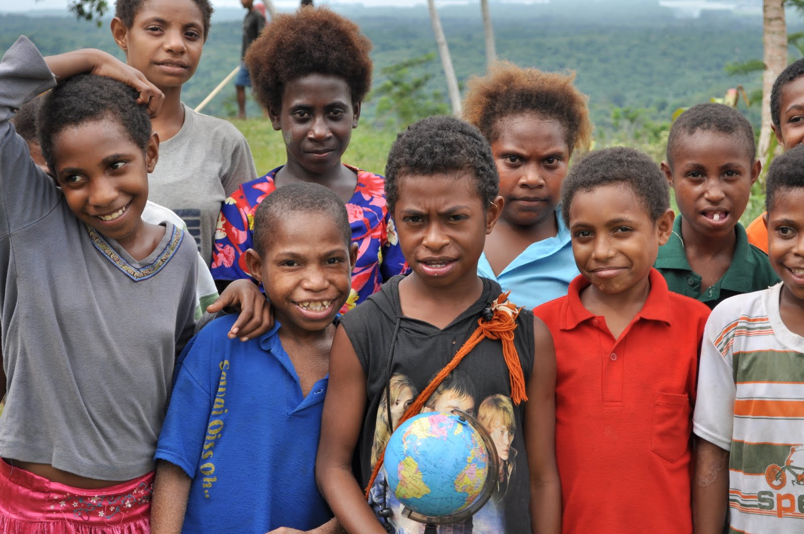
Left image: View from the classroom at Brahaim Primary School, 20 kms out of Madang, PNG.
Right image: Children with the world in their hands at Brahaim Primary School.
Related sites to the Spatialworlds projectSpatialworlds website21st Century Geography Google GroupAustralian Geography Teachers' Association website'Towards a National Geography Curriculum' project websiteGeography Teachers' Association of South Australia websiteEmail contactmanning@chariot.net.auWhere am I??Madang, Papua New Guinea: S: 5º 13' E: 145º 47'
A Place, Space and Environment look at Madang PNGI have been in Madang for the past week, visiting schools, talking to geography teachers and just looking around. It has been a wonderful experience and over the next few days as I travel home I will try to put down my thoughts on Madang through the geographical lens. In the last posting I discussed the conceptual geographical pre-thinking I had on Madang. In this posting (and maybe a few following)I will try to summarise my thoughts and impressions on this amazing place through the geographical lens (in accordance with the concepts of the Australian Curriculum: Geography) discussed previously.
I intend to write an article on my journey to Madang for the geography teachers’ association journal in Australia in coming weeks and as a result will make this blog posting a dot point summary of my observations/information under the key concepts of Place, Space and Environment from the draft Australian Curriculum: Geography. Note that I have combined the concepts of Place and Environment because of the obvious entwinement of the two. More about that issue in a later blog.
Place and EnvironmentThe Madang Province:• is one of the
largest region of Papua New Guinea• is primarily covered in dense tropical rainforest vegetation.
• major central place is the city of Madang (population 27419)
• has a
population of 365,106 (2000 census). The 2011 census is presently being conducted
• has 40% of its population under 15
• has a
Crude Birth rate of 28.76 births/1,000 population,
Death Rate of 8, Infant Mortality rate of 93 and life expectancy of approx 60 (58 for men and 60 for women).
AIDS (208 000 in PNG will be living with HIV in 2012) and Malaria (40% of population infected) are two serious diseases in PNG.
• has a
population primarily of Papuan New Guineans comprising islanders, coastal people, river people and mountain people
• is a mixture of peoples i.e. tall lithe coastal people from Karkar Island, short nuggety highlands men from Simbai and river people from the Ramu
• is on a plate boundary and has frequent earthquakes and is surrounded by volcanic islands to the North
• is composed of seven designated districts, with each district having one or more local level governments
• people have limited income with employment opportunities small, wages low and education costly (limits opportunity for those in villages who cannot afford to go to costly secondary education in centres such as Madang). Missions still play an important role in providing opportunity through education
• has the major rivers of the Ramu, Sogeram, Gogol and Malas
• the influence of missions is still evident. Signs of Christianity are quite overt in schools, shops and other institutions
• is the third leading producer of cocoa and copra and second producer of cattle. Ramu Sugar, Coconut Oil Production Manang Ltd and Jant/Gogol woodchip mill are amongst PNG's biggest employers
• seems to have few Asians in the population and the number of Europeans is minimal today. An expatriate community does still exist, working in major industries and some of the services but this is extremely small compared to the past. Most English, Europeans and US citizens living in Madang province are involved with missions or voluntary overseas aid services
• people outside of the Madang township still live in traditional houses built from natural materials and are dispersed as village settlements
• people are primarily involved in subsistence agriculture (95%). The crops grown are taro, sweet potato, betel nut, bananas, coconut and mustard plant
• major villages are along the coast and inland along the rivers and main roads. The major villages often have a primary school attached, either run by the missions or the government. Although these schools are staffed by trained teachers(most trained in Madang Province), they
lack resources such as books, equipment such as computers and adequate buildings and furniture. I found that computers for student use (and teachers in most cases) are a world away and that books and writing material remain a luxury in Madang Province schools. I spent a great morning with the geography teachers at Tusbab Secondary School introducing them to GIS on their single computer in the school
•and it’s people have a strong allegiance to Papua New Guinea and are proud of their independent PNG identity. Their national anthem has pride of place in their schools
• people have the reputation of being friendly and happy. I found this to be true with nothing but hello’s, smiles and handshakes – they even asked for the photo taken! As the Russian anthropologist
Mikloucho-Maclay, who lived in Male area of the province for 15 months in 1871 said, the area of Astrolobe Bay was the “Archipelago of contented people.”
Madang: • has a
Tropical climate with average temperature of 26.6 °C (average range of average monthly temperature of 1 degree) and a yearly rainfall of 3440mm with the
greatest amount falling from October – May (152 days annually on which greater than 0.1 mm). April is the wettest month (439mm) and driest month.
• is fringed by volcanic material on its shore which plummets directly to the deep ocean floor. A lighthouse (memorial to the World War 2 Coastwatches) has been built on the Madang foreshore to warn shipping of this hazardous geomorphology. Along the coast of the Madang Province, the beaches are of steeply sloping weathered grey sand. Dense vegetation comprising jungle and coconuts fronts the beaches
• is the Madang Province's major port for shipping goods
• people live along the coast and surrounding islands and regularly travel by small boats (25 crowded in no more than a 8 metre fiberglass dingy powered by an outboard)
•people describe themselves as coastal people and consider that they are somewhat different to those from other areas of PNG, in particular the Highlands
• has limited infrastructure and is challenged in maintaining what it has i.e. severely pot holed city bitumen roads, transport networks (dirt roads) to villages and rubbish removal (terrible litter everywhere in Madang city) and dilapidated school buildings, to name just a few indicators
• has to the south the Bismarck Range with heights ranging over 4,000 metres. Mount Wilhelm, PNG's tallest mountain at 4509m, is found in these ranges
• is a focal point providing essential services such as banks, hospitals, schools, shops. In the countryside food markets are common place selling the subsistence crops of the villagers. These markets are also the transport hubs with villagers being trucked in by vans, utes, and trucks
• is claimed to be the tourist centre of PNG with several resorts and tourist orientated services (diving and fishing tours). Even so, due to the cost, lack of publicity and perceived ‘non-safe’ nature of PNG the tourist industry is small compared to other part of Asia and the Pacific. Although the cost was expensive, I found the people friendly, conditions safe and services adequate. Interestingly at no time as I walked around Madang or the villages in the province was I asked for money, asked to buy something, not greeted warmly or waved at
• is an aesthetically very beautiful place with sea, harbour, mountain and jungle vistas.
Space: observations related to location and distributionMadang Province:• is a large region of approximately 300 kilometres long and 160 kilometres wide with four large and many small offshore islands
•is to the North of Port Moresby, the capital of PNG
• is linked primarily by air and sea to Port Moresby
• has the sea on its Northern perimeter and the Bismarrck Range on its Southern
• has major rivers criss-crossing the province from south to north as they drain from the Bismark Range (Ramu, Sogeram, Gogol and Malas Rivers)
• has long term major villages evenly spaced along the south eastern coast of Astrolabe Bay (Male, Bongu, Gorendi, Garagasi, Koliku), and on the northern eastern coast of Astrolabe Bay(Bili Bili, Bogadjim, Gorima and Erima)
• the population in Madang Province is concentrated along the rivers, on the coast and on the hilltops. The population was not and is not evenly populated. Even today there are uninhabited areas of the province
• there are over 20 languages spoken just in the Astrolabe Bay area of the province which correspond with the major populated areas. Linguistically, Madang province is typified by a large number of very small language groups
•population is denser in the highland areas than in the coastal zone.
Madang:• is located on the Northern East shore of Papua New Guinea
• is located on the Northern West shore of Astrolabe Bay
• is an indentation in Astrolabe Bay which provides a natural harbour and estuary
• is linked to Lae by a East- West road.