Sunday, April 29, 2012

Interacting with the Interconnection concept

Kony2012: A geographical case study?


A world diminishing in size due to technology


Related sites to the Spatialworlds project
Email contact
manning@chariot.net.au
Where am I??
Adelaide, Australia: S: 34º 55' E: 138º 36'


The Interconnection concept


Following on from the Facebook connections map showcased in the last posting, I thought it worthwhile to explore the Interconnection concepts of the Australian Curriculum 
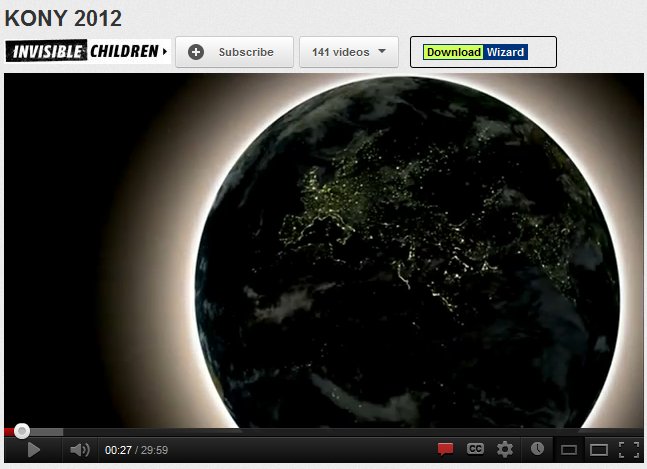
Geography. I was further prodded to do so after watching the YouTube video on the Kony2012 initiative.

I kept asking myself, is this geography and could it be used in a geography class?  Is it political geography, cultural geography, human well-being, development geography, demography?  Can such a phenomenon and resource be used as a case study in geography.  To explore this idea I revisited the Interaction concept (one of seven Australian Curriculum: Geography concepts) and had a look at several units which have been written for the draft curriculum released in October 2011 (namely Global Connections and Human Well-being).  So what is the concept of Interconnection according to the draft Australian Curriculum: Geography.

The concept of Interconnection (draft AC: Geography page 9) 

The concept of interconnection, in geography, emphasises that no object of geographical study can be viewed in isolation. It is about the ways that geographical phenomena are connected to each other through environmental processes, the movement of people, flows of trade and investment, the purchase of goods and services, cultural influences, the exchange of ideas and information, political power, international agreements and other types of interaction across space.

• exploring the networks that channel the interconnections between places, and which can advantage some places and disadvantage others
• learning to see their own locality in a wider national and global context, and gaining an understanding of the external factors that influence the locality’s present and future

The concept of interconnection is particular alive and well in the following units of the draft curriculum

The Year 9 unit called Navigating global connections

This unit focuses on the connectedness of Australia with its region and the world. This is explored initially through the eyes of the student and the connections and contacts they have with the wider world in their everyday lives. The unit then looks at the nature of Australia’s connections (with particular emphasis on social and economic connections) and the positive and negative impacts of these connections. The ability of a student to act locally, but with a regional and global view of the consequences is investigated.

Year 10 unit called Global well-being
This unit focuses on the nature of well-being around the world and how can it be measured. Spatial characteristics of well-being and the factors that influence it, and the inequalities that exist at a variety of scales, are used to investigate programs that address issues of well-being.

Content descriptions from unit
There are interrelationships between human well-being and conflict
  • There are significant spatial variations in human well-being within nations, at both regional and local scales 
  • A non-government program which attempts to improve human well-being in another country, and why such programs may be spatially targeted at specific regions within the country
  • People are connected to places across the world through their cultural interests and activities


There are many other places across the draft curriculum where the concept of interconnection is fundamental to the geographic understanding of the topic studied.  I have selected these units because they are particularly pertinent to using the Kony2012 initative as a case study of a geographical phenomenon. So how is the Kony2012 a geographical study. The following quotes from the video have a geographical and interconnection flavour which makes it possible as a geographical study under the guise of cultural geography and political geography in particular. 
  •  “Planet connection through technology.”
  •  “Technology enables us to connect anywhere, anytime ... This connection is changing the way the world works.” In short the video is highlighting the fact that technology is making space diminish through the power of technology leading to increased global interconnection.
  •  “There are more people on Facebook today than there were on the planet 200 years ago.”
  • “Humanities greatest desire is to belong and connect.”
  •  “Where you live should not determine whether you live?
  • “It is not just important for one people but for everyone to capture and stop Kony.
  • “Kony’s name needs to be everywhere.”
  • “Will use 20 culture makers to make Kony famous?
  • “Today the people of the world can see each other and can protect each other.”
  • “The power of media to mobilise the world to act.”
  • “To change the conversation of a culture.”
  • “We are living in a new world, a Facebook world where 750 million people share ideas, not thinking in borders, it’s a global community.”
  • “Arresting Joseph Kony will prove that the world we live in has new rules, that the technology that has brought our planet together is allowing us to respond the problems of our friends – a place where children, no matter where they live have a childhood, free from fear.”

Does this not sound like geography with its spatial and interconnection conceptualisation as discussed in the draft curriculum document? 

For more information on the Kony2012 initiative go to:

As a footnote to this reference to Kony2012 it is worth examining the controversy surrounding this initiative in terms of the recent reports on the use of funds, scamming accusations and the mental health of the film-maker Jason Russell, the driver of Kony2012. A fascinating case study, relevant to geography, populist media in nature, current with layers of truth and purpose.  Surely it can be made a geographical study to engage students and for them to learn about the concept of interconnection...and space.

 The Age of Interconnection: The Anthropocene


Whilst on the concept of Interconnection it is worth referring to the so called new age of the Anthropocene. The Anthropocene is best defined as the new human-dominated period of the Earth's history, the age of interconnection around the globe. 
Technically, the Anthropocene is the most recent period of the Quaternary, succeding to the Holocene. The Quaternary is a period of the Earth's history characterised by numerous and cyclical glaciations, starting 2,588,000 years ago (2.588 Ma). The Quaternary is divided into three epochs: the Pleistocene, the Holocene, and now the Anthropocene.The following links show this interconnection qualities of the Anthropocene rather well.


The term and the concept of the Anthropocene, the idea that human activity affects the Earth to the point where it can cross a new age, is not new and dates back to the late nineteenth century. It seems that the success of the term and its recent currency and adoption is due to the luck of having been made at the appropriate time, when humankind has become more than ever aware of the extent of its impact on global environment. 


Friday, April 27, 2012

What raw data just can't show: geographical visualisations


Japanese Tsunami wave height map


Visualisation of Facebook traffic


Related sites to the Spatialworlds project
Email contact
manning@chariot.net.au
Where am I??
Adelaide, Australia: S: 34º 55' E: 138º 36'


 Translating data to the visual

Here is yet another great blog on maps and spatial visualisations.  This time from James Cheshire Centre for Advanced Spatial Analysis, University College London and his blog is called Spatial Analysis.co.uk.  I must thank our geography colleague Bridget Fleming from South Africa for passing on this amazingly rich spatial blog.  Just enjoy and wonder at what the representation shows us that raw data never can.   

One of the really good things about many of these visualisations is their currency – of the latest phenomenon (Twitter, Facebook), events, disasters and daily commuting and happenings - all extremely relevant to the life’s of young people. Although very UK and to a lesser extent United States–centric, the maps are a great resource to get over the message about the power of visualisations to provide instant analysis.

The visualisation of a dataset which contains digitised information from the log books of ships (mostly from Britain, France, Spain and The Netherlands) sailing between 1750 and 1850.

Also have a look at the Map Gallery on the site and see fascinating maps of things such as the Twitter languages of London, travel distances on London Underground, Muslim populations by countries,


If you want to look at these maps and their background in more detail, the site provides that opportunity as shown below.

Brilliant maps of “generic” terms for rivers in the United States and UK. These map shows how different cultural and linguistic factors have influenced the naming of geographic. For example French settlers named the streams they encountered “bayous”.
On the topic of naming, settlement names also have a clear geography as they, like rivers in the US, reflect the different settlers (or invaders!) of the British Isles over millennia. The map below (taken from my thesis) shows the different naming influences on settlements in Britain.


Amazing visualisations produced for the BBC’s Britain from Above series. The taxis in London create a fantastic impression of the diurnal rhythms within the city. The air traffic over Britain animation (below) is just as impressive. I was especially taken by the amount of “stacking” that takes place over British airports.


* Best maps of 2011 according to the Spatial Analysis blog
 
Two other links of interest on the Spatial Analysis site.

Wednesday, April 25, 2012

WOW: I can see for miles and miles

Hills outside of Melbourne

ANZAC Day 2010 at Villers-Bretonneux, France


Related sites to the Spatialworlds project
Spatialworlds website
21st Century Geography Google Group
Australian Geography Teachers' Association website
'Towards a National Geography Curriculum' project website
Geography Teachers' Association of South Australia website
Humsteach blog
Email contact
manning@chariot.net.au
Where am I??
Adelaide, Australia: S: 34º 55' E: 138º 36'

WOW!  I can see for miles and miles


It is worth another posting on AirPano, a virtual site which provides 360 degrees images and fly-arounds from around the world. AirPano is a non-commercial project focused on high resolution 3D aerial panoramas. AirPano team is a group of Russian photographers and panorama enthusiasts. During the next 2-3 years they plan to shoot the aerial panoramas and create the virtual 3D tours of the most interesting places of our planet.
Start on the home page and visit New York, Iceland, the Maldives, South America, the Himalayas and the Caribbean and then go to the World Map tab on the top menu. Plotted on the map are the locations photographed by AirPano around the world.

Just a click gives you panoramic views of places you wish to virtually explore
...click on any of these place names below and explore ...


Victoria Falls, ZambiaVenezuela, Surroundings of Angel Falls, VenezuelaAngel falls, VenezuelaKalyan Minaret, Bukhara, Uzbekistan Miami, USALas Vegas, USALake Powell, USAManhattan, New York, USAGolden Gate Bridge, San Francisco, USAMillennium UN Plaza Hotel, New York, USAOahu, Hawaii, USALas Vegas, Nevada, USAMillennium UN Plaza Hotel, New York, USAGolden Gate Bridge, USAStatue of Liberty, New York, USAManhattan, New York, USAHollywood, California, USASan Juan and Colorado rivers, USAGoosenecks, Utah, USAMono Lake, California, USAMillennium UN Plaza Hotel, New York, USAChicago, Illinois, USALos Angeles, California, USAKiev, UkraineAy-Petri, UkraineDubai, UAEDubai, Islands, UAEPalm Jumeirah, Dubai, UAEBangkok, ThailandSankt-Moritz, SwitzerlandCape Good Hope, South AfricaCape-Town, South AfricaMoscow, MSU, RussiaMoscow, Kremlin, Bolotnaya Square , RussiaMoscow, RussiaMoscow Kremlin, Russia55.748765;37.540841, RussiaMoscow City, RussiaKremlin, Moscow, RussiaMoscow City, RussiaTrinity Lavra of Sait Sergius, RussiaSaint-Petersburg, RussiaNew Jerusalem Monastery, RussiaSaint Petersburg, RussiaNovodevichy Convent. Moscow, RussiaRamenki,Moscow, RussiaMKAD, Moscow, RussiaMoscow, RussiaMoscow, RussiaKrokus Expo Center, Moscow, RussiaMoscow Region, RussiaMoeraki Boulders, New ZealandFiordland, New ZealandNepal, NepalMaldives, MaldivesKuala-Lumpur, MalaysiaGrimsvotn, IcelandAmsterdam, HollandNeuschwanstein Castle, GermanyEgyptian Pyramids, EgyptHong Kong, ChinaThe Iguassu Falls, BrazilTwelve Apostles Marine National Park, AustraliaSydney, AustraliaBuenos Aires, Argentina

What a wonderful way to tour the world! You can also save for future "flashbacks".


Saturday, April 14, 2012

The WOW factor of geography: WOW = World of Wonder!


Related sites to the Spatialworlds project
Spatialworlds website
21st Century Geography Google Group
Australian Geography Teachers' Association website
'Towards a National Geography Curriculum' project website
Geography Teachers' Association of South Australia website
Humsteach
Email contact
manning@chariot.net.au

Where am I??
Adelaide, Australia: S: 34º 55' E: 138º 36'


The wonder factor of geography

Quite a bit of discussion has happened around the ACARA writing process for the Australian Curriculum: Geography in regards to the need to make the aim of a “sense of wonder” prominent in the aims of the course. Some were concerned that it was not an academic aim and how do you assess a sense of wonder of our world. However the long tradition of geographers being explorers with a need to satisfy curiosity (a previous Spatialworlds posting explored inquisitiveness in geography) and engender wonder has always been at the centre of geography. Thankfully this desire amongst geographers has been listened to and the first aim (no coincidence being first aim either!) of the Australian Curriculum: Geography reads:

...to ensure that students develop:

Aim 1: a sense of wonder and curiosity about places, people, cultures and environments throughout the world


Here are just a few Internet sites that can be used in the geography classroom to engender wonder of the world, so that students say WOW.


1. The BBC Human Planet Explorer: wondrous video clips galore


I thought it would be good in this posting to point geography teachers to the excellent BBC site titled “Human Planet Explorer”. This site is a great resource for the geography teacher wanting to develop a sense of wonder and curiosity with students.

The site contains hundreds of amazing human stories from around the world through television and radio clips from BBC programmes such as Human Planet, Amazon with Bruce Parry and Tropic of Cancer. Human Planet Explorer enables teachers and students to browse a selection of clips that showcase man's relationship with the natural environment. Check the video clips on Environments, Seasons, Life events , Survival skills, Countries, Events and Festivals and other BBC video collections. They will certainly build a sense of wonder of our world for geography students.

Here is just one and a selection of a few others worth exploring on the site. Be prepared to spend a few hours of wonder and curiosity.

* Tidal movements under the ice.
The tide goes out even under the ice. This amazing video shows the pulsating movements of the sea and ice.
People risk their lives gathering every day necessities, namely food! It is very interesting what people of the northern Arctic regions have done for so long.

Just wait till the end of the tidal ice YouTube and click on BBC1 and see some of the following magnificent videos of our world. Here are just a few wondrous ones:

* Nomads Life – Eagle hunter
* Emptying a lake in minutes
* Tuna fishing in the South Pacific
* Paddle surfer riding huge wave
* An uncontacted Amazon tribe from the air
* Fishing in the Philippines

2. The Earth from Space now!


Andre Kuipers, space station astronaut TwitterS pictures from space: astronaut on the International Space Station sends pictures back to Earth via his Twitter account, Astro_andre.

3. Geography Association’s “A Different View”

Have a look at the video to accompany 'a different view' the Geographical Association's 2009 'Manifesto' for school geography. Geography is about discovering the world… and its complexity Geography deepens our understanding of the world Geography fascinates and inspires Thinking geographically … thinking critically … about what we see and understand This can be shown without any preamble as to its purpose as hopefully the movie makes it clear what it is for. A video to show the WOW factor of geographical thinking.


4. The NASA Earth Observatory site

This amazing source of satellite images of the Earth has been around for a while but never ceases to engender wonder of the world.

5. An interactive map showing population density of the earth.

A great example of visual literacy for learning.


Developing a sense of wonder, a type of Sunshine Geography is how we will attract students to geography - not the Death Geographies as described in the UK which focus on doom and gloom of the planet. In Australia we could call this the "We will all be ruined Geographies!" More on that discussion in a future Spatialworlds posting.

Sunday, April 8, 2012

Never too young for geography


Related sites to the Spatialworlds project
Spatialworlds website
21st Century Geography Google Group
Australian Geography Teachers' Association website
'Towards a National Geography Curriculum' project website
Geography Teachers' Association of South Australia website
Humsteach
Email contact
manning@chariot.net.au

Where am I??
Adelaide, Australia: S: 34º 55' E: 138º 36'


Images above: Students "doing geography" at Cowandilla Primary School in Adelaide, Souh Australia.


We are reading the globe!


Whilst not advocating teaching extremely young children meaningless place names such as has been shown on various YouTube videos in recent years, there is a place for introducing geography in the earliest years of schooling. This posting is dedicated to the work of Years 1-2 teacher Tina Photakis at Cowandilla Primary School. Tina participated in both the DECD and ACARA geography trials in 2011 and did some outstanding work introducing geography to her students, with all its paraphenalia of maps, globes and spatial thinking. The trial focussed on the draft Australian Curriculum: Geography Years 1-2 outlines, with a focus on geographical thinking and the use of spatial technology.

The trial focussed on the following Year 1 and 2 descriptions from the draft:

The Year 1 curriculum expands the understanding of familiar places explored in Foundation. Students are guided to see familiar places as part of bigger places and they begin identifying how places change. Spatial understanding is expanded from exploring the arrangement of space in Foundation to recognising ways that places are used. The inquiry process is guided and students are introduced to geographical tools that help them develop their skills and answer their questions.


The Year 2 curriculum builds on student learning about places in earlier years by exploring people’s connections with other places. Students then expand their geographical knowledge by finding out about these other places and using an increasing variety of information sources. Their spatial understanding is extended from reviewing the use of spaces to examining how distance influences the places they go to.

Hear lead teacher Tina Photakis talk about the trial in her 1-2 class last year. A great and informative trial for the development of the Australian Curriculum: Geography - well done to all involved.


Thanks to the generosity of the Cowandilla Primary School students and teachers in giving permission for their teaching materials and reflections to be part of this blog. In particular thanks to Tina Photakis, the lead teacher for the trial at Cowandilla Primary School.

Saturday, April 7, 2012

Fieldwork: the geographers laboratory


Images of Loxton High School students doing fieldwork on the River Murray, South Australia.

Related sites to the Spatialworlds project
Spatialworlds website
21st Century Geography Google Group
Australian Geography Teachers' Association website
'Towards a National Geography Curriculum' project website
Geography Teachers' Association of South Australia website
Humsteach
Email contact
manning@chariot.net.au

Where am I??
Adelaide, Australia: S: 34º 55' E: 138º 36'


River fieldwork to study the Year 8 draft "Landscapes" unit.

This posting showcases the DECD trial project on fieldwork at Loxton High School in South Australia during October 2011. The trial used the draft Year 8 unit on Landscapes, with a focus on the use of fieldwork involving the integration of spatial technology.

The Year 8 Landforms and Landscape unit of the Australian Curriculum: Geography focuses on the nature of landscapes and the forces, processes and factors which shape them physically, as well as people’s perceptions and use of them. The unit examines, at a variety of scales, how landscapes fundamentally affect the ways in which people live and also how landscapes are modified and managed.

The Loxton High School students did some great fieldwork along the River Murray whilst studying this unit. Lead teacher Jo Simon talk about the trial in her Year 8 class last year. A great and informative trial for the development of the Australian Curriculum: Geography - well done to all involved.


Thanks to the generosity of the Loxton High School students and teachers in giving permission for their teaching materials and reflections to be part of this blog. In particular thanks to Jo Simon, the lead teacher for the trial at Loxton High School.

Friday, April 6, 2012

Out in the field with Year 7 AC: Geography


Images of students doing fieldwork in the town of Johnberg outside of Orroroo, South Australia.

Related sites to the Spatialworlds projecthttp://www.blogger.com/img/blank.gif
Spatialworlds website
21st Century Geography Google Group
Australian Geography Teachers' Association website
'Towards a National Geography Curriculum' project website
Geography Teachers' Association of South Australia website
Humsteach
Email contact
manning@chariot.net.au

Where am I??
Adelaide, Australia: S: 34º 55' E: 138º 36'


Fieldwork to study the unit "Why people live where they do?"

As mentioned in the last post, these next few postings will showcase several schools in South Australia using fieldwork in the context of the Australian Curriculum: Geography. This posting is focussed on the work of Orroro Area School during October 2011.

The "Why people live where they do" unit of the Austrlaian Curriculum: Geography focuses on investigating the reasons why people decide to live where they do, at a variety of scales and in the context of the environmental, economic, social and other factors that might influence decision making. The ability to choose where to live is not always available to people and it should be recognised that the unequal distributions and concentrations of populations has consequences.

The Orroroo students did some great fieldwork in the township of Orroroo and in the nearby ghost town of Johnberg. Hear lead teacher Marg Custance talk about the trial in her Year 7/8 composite class last year. A great and informative trial for the development of the Australian Curriculum: Geography - well done to all involved.


Thanks to the generosity of the Orroroo Area School students and teachers in giving permission for their teaching materials and reflections to be part of this blog. In particular thanks to Marg Custance, the lead teacher for the trial at Orroroo Area School.

Getting out and about: Fieldwork in geography


Images above: Students at Findon High School in Adelaide collecting data in the field - from within the school grounds to the outback - all fieldwork!


Related sites to the Spatialworlds projecthttp://www.blogger.com/img/blank.gif
Email contact

Where am I??
Adelaide, Australia: S: 34º 55' E: 138º 36'


Fieldwork: The geographers lab

"Schools should place a renewed focus on traditional geography field trips to stop pupils being trapped behind computer screens in the classroom", Michael Palin has warned.


Field work is the process of observing and collecting data about people, cultures, and natural environments. Field work is conducted in “the wild” of our everyday surroundings rather than in the semi-controlled environments of a lab or classroom.


One of the hotspots during discussions as the Australian Curriculum: Geography has been developed and written has been the place of fieldwork in geography. Most geographers see fieldwork as fundamental to good geographical education and consider that it is fieldwork which makes our subject unique in the school curriculum. Whilst the discussion is not on the worth of fieldwork, the issues are about to what extent we can mandate it and make it an expectation of all who teach geography from F-12. Issues of inclusivity for all, cost, risk, ability of non-geography teachers to conduct fieldwork and the time involved (often in other class time) come into the equation as jurisdictions and schools consider the mandating of fieldwork for all year levels.
It is worth noting at this stage that one of the aims of geography stated in the January 2011 Australian Curriculum: Geography shape paper was:

To develop students’ ability to ask geographical question, plan an enquiry, collect and analyse information, (particularly through fieldwork and spatial technology) ...

However one notes that the direct mention of fieldwork was removed from the aims in the October 2011 draft scope and sequence which reads as:

.. that students develop:
the capacity to be competent, critical and creative users of geographical inquiry methods and skills

Fieldwork does appear in the Rationale though when it is stated that:

Fieldwork, the mapping and interpretation of spatial distributions, and the use of spatial technologies are fundamental geographical skills

If we are going to see fieldwork embedded in the aims and pedagogical expectations and in turn mandated, we need to review the nature of fieldwork, reasons why it is so important and provide a few examples for consideration. This posting and the next few are dedicated to these fieldwork considerations. Hopefully they provide useful background for the writers of the Australian Curriculum: Geography to mandate fieldwork in our schools, as all classroom geographers desire.

In essence, geographers regard fieldwork as a vital instrument for understanding our world through direct experience, for gathering basic data about this world, and as a fundamental method for enacting geographical education.


This YouTube called “Why is fieldwork important to geography” from our friend in the States, Joseph Kerski, President of American Geographers is a good starting point.


On the issue of the benefits of fieldwork the Royal Geographical Society in the UK says:

Fieldwork is an important part studying geography. Fieldwork offers a wonderful way of seeing the world, and a chance for personal development. Doing fieldwork can make a difference to your life and future career.

They go on to cite the benefits of fieldwork as:

Seeing geography and theories come to life
- improving your knowledge of geography and understanding
Developing your skills - givnig you a chance to learn skills such as:• data collection and analysis, map work, observational and investigative skills
• computer and technology skills
• communication and mathematical skills
Appreciating environments – giving you a chance to experience and enjoy a wide range of environments and landscapes
Opinions & views – It helps you to understand other peoples and cultures, and your own views about social, political or environmental issues
Learning, communication, confidence - you take responsibility for your learning, gaining confidence and develop skills, such as leadership, teamwork and communication
It’s fun!


At this stage, before watching the South Australian fieldwork trials which will be showcased in the next few postings, it is useful to look at the fieldwork packages and the associated pedagogies on a wide range of fieldwork from the Barcelona Field Studies Centre in Spain. Great case studies!

To support our thinking on the pedagogy of fieldwork, the types and examples from the Field Council site in the UK are also a great resource to review.