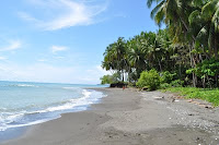

Images above: Madang Province, a slice of paradise!
Related sites to the Spatialworlds project
Spatialworlds website
21st Century Geography Google Group
Australian Geography Teachers' Association website
'Towards a National Geography Curriculum' project website
Geography Teachers' Association of South Australia website
Email contact
manning@chariot.net.au
Where am I??
Adelaide, Australia: S: 34º 55' E: 138º 36'
Bits and pieces to have a look at!
1. What can one say? The images just continue to come of the Japanese tsanami.
2. A visualisation which puts the US debt into perspective.
3. State of the Sea Turtles: an interesting interactive map application of spatial technology.
4. Disaster simulation game using interactive maps
5. Great weather site called Weather underground
6. Spatial literacy sites of interest
* FAQ on Spatial literacy
* A practical spatial literacy exercise
* A useful spatial literacy orientated Facebook page: Geomatica
7. World name profiler: Putting the Geo into Genealogy: A great Spatial Literacy project out of the University College London, the University of Leicester and the University of Nottingham.
World name profiler now active
Go to this site and type in a family name and get a thematic map of the world showing the range of the name across the world. Click on a country to get an even more detailed thematic map (especially for England, Europe, Australia and the US). Fantastic! A more detailed UK search profile is the Great Britain Public Profiler which investigates the geography of surnames in Great Britain, both current and historic. It allows users to search the databases that have been created, and to trace the geography and history of their family names.
Associated with the Public Profiler site are:
* The Onomap software tool classifies any list of names into groups of common cultural ethnic and linguistic origin using surnames and forenames. It can be run in a standalone version that requires no installation or internet connectivity, making it a valuable name coding tool for secure operating environments.
* The Censusprofiler Website presents a comprehensive picture of Great Britain's neighbourhoods in a national context using a unique open source mapping interface to the 2001 Census of Population.
* The London Profiler which visualises a London neighbourhood's profile using different area classifications through the Google Map interface.
No comments:
Post a Comment